

River
Dudh Koshi River
दूधकोशी
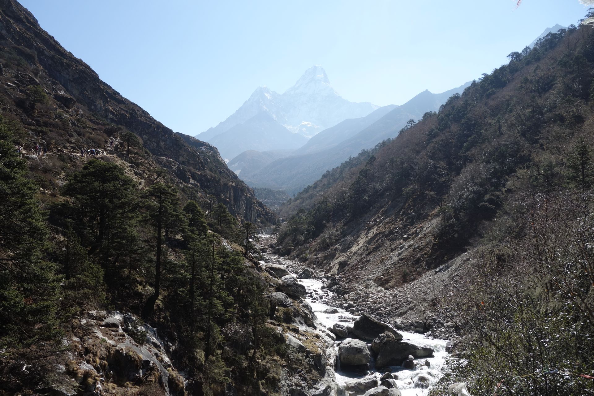
The Dudh Koshi, or “milk river”, drains the Everest Region, flowing from the Gokyo Lakes and Ngozumpa Glacier south past Namche and Lukla to join the Sun Koshi. Its milky glacial water gives it its name.
- Elevation: ~1,200–5,000 m
- Type: River
- Region: Everest Region
- District: Solukhumbu
- Name means “milk river”
- Treks: Everest Base Camp Trek, Gokyo Lakes Trek
About Dudh Koshi River
The Dudh Koshi River is one of the most important Himalayan rivers in eastern Nepal. Flowing through the famous Everest region of Solukhumbu District, it drains water from the glaciers, snowfields and high-altitude lakes surrounding Mount Everest, Cho Oyu and other Himalayan peaks. The name “Dudh Koshi” means “Milk River” in Nepali, referring to the pale, milky appearance of its water, which carries fine rock sediment from glacial sources.
The river is a major geographical feature of Sagarmatha National Park and the wider Khumbu region. It flows south through deep mountain valleys, passing near important trekking settlements and joining other rivers before continuing towards the larger Koshi River system. Its tributaries, glacial valleys and surrounding landscapes are central to the natural environment and trekking experience of the Everest region.
Location and Geography
The Dudh Koshi River is located in eastern Nepal and forms part of the upper Koshi River basin. Its upper catchment lies within and around Sagarmatha National Park, where several major glaciers and tributaries contribute to its flow.
- Nepali Name: दुधकोशी नदी
- Location: Solukhumbu District, Koshi Province, Nepal
- Region: Everest and Khumbu region
- River System: Koshi River system
- Main Water Sources: Himalayan glaciers, snowmelt, rainfall and tributaries
- Important Tributaries: Imja Khola and other mountain streams
- Nearby Settlements: Namche Bazaar, Monjo, Phakding and areas around Lukla
- Protected Area: Sagarmatha National Park and its buffer zone
The exact description of the river's headwaters varies between geographical and scientific sources because several glacier-fed streams join across the upper Khumbu valleys. The national park's management plan identifies the Khumbu, Ngozumpa and Imja glaciers among the major glacial sources feeding the Dudh Koshi system.
River Course and Major Tributaries
The Dudh Koshi drains the high Himalayan landscape southwards. Its upper catchment includes glacial valleys around Gokyo and the Khumbu, while tributaries from the Imja Valley and western Khumbu contribute additional water.
Upper Dudh Koshi and Gokyo Valley: The upper river system receives water from the Ngozumpa Glacier and surrounding high-altitude lakes and streams. The Gokyo Valley is one of the most recognisable landscapes in this upper catchment.
Imja Khola: This important tributary drains the Imja Valley, including water from the Imja Glacier and surrounding mountain slopes. It joins the Dudh Koshi system farther downstream.
Khumbu Valley: Glacial streams from the Khumbu Glacier and surrounding mountains contribute to the river network in the Everest Base Camp region.
Namche and Lower Khumbu: The river system passes through deep valleys and rugged terrain near the main Sherpa settlements. The Bhote Koshi and Dudh Koshi waterways meet near Larcha Dovan below Namche, according to the Sagarmatha National Park management plan.
Downstream River System: After leaving the upper Khumbu region, the Dudh Koshi continues south and eventually joins the wider Koshi River system.
Treks That Follow the Dudh Koshi River
The Dudh Koshi River is a defining feature of several popular trekking routes in the Everest region. Many trails follow its valley, cross its tributaries and pass through forests, suspension bridges and traditional Sherpa villages.
Everest Base Camp Trek: The classic route from Lukla passes through Phakding, Monjo and Namche Bazaar, following the Dudh Koshi Valley before climbing towards Tengboche, Dingboche and Everest Base Camp.
Gokyo Lakes Trek: This route explores the upper Dudh Koshi catchment, with access to the Gokyo Lakes, Ngozumpa Glacier and Gokyo Ri.
Everest Three Passes Trek: The challenging Three Passes circuit crosses several high mountain valleys connected to the Dudh Koshi river system, including the Gokyo and Imja areas.
Namche Bazaar to Phakding Trek: The lower section of the Everest trail follows the river through forests, suspension bridges and small settlements.
Dudh Koshi Valley Trek: The river corridor provides access to traditional villages, mountain viewpoints and the natural landscapes of Sagarmatha National Park.
Tea Houses and Accommodation Along the Dudh Koshi River
The Dudh Koshi River is not a single accommodation destination, but its valley contains numerous villages and trekking stops with tea houses, lodges and guesthouses. These facilities support trekkers travelling towards Everest Base Camp, Gokyo and the Three Passes.
Popular places to find accommodation along or near the river corridor include:
- Phakding: A popular first-night stop after Lukla, with a range of trekking lodges and tea houses.
- Monjo: A small village near the entrance checkpoint to Sagarmatha National Park, offering basic accommodation.
- Namche Bazaar: The main service centre of the Khumbu, with a wider selection of lodges, restaurants, shops and other facilities.
- Tengboche: A mountain settlement with tea houses and lodges near the famous monastery.
- Pangboche: A traditional Sherpa village with trekking accommodation and views of the surrounding mountains.
- Dingboche: An important high-altitude overnight stop with several tea houses and lodges.
Tea houses generally provide rooms, shared dining spaces and meals such as dal bhat, noodles, soups, rice, potatoes and hot drinks. Facilities vary by village, elevation and season. Trekkers should check availability during quieter months and carry sufficient cash for remote sections of the route.
Nature and Landscape of the Dudh Koshi River
The Dudh Koshi River flows through some of Nepal's most spectacular Himalayan scenery. Its landscape changes from high glacial valleys and rocky mountain slopes to forested river gorges and lower-altitude green hills.
Glaciers and Snowmelt: The river system is fed by major Himalayan glaciers, including the Khumbu, Ngozumpa and Imja glaciers. Meltwater contributes to the river's flow, especially during warmer months.
Deep River Valleys: In the upper Khumbu, the river and its tributaries flow through broad glacial valleys. Farther downstream, the water cuts through steep-sided gorges and rugged mountain terrain.
Forests and Vegetation: Lower sections of the valley contain pine, fir, birch, juniper and rhododendron vegetation. Higher elevations gradually transition into alpine grasslands, shrubs and sparse mountain plants.
Mountain Wildlife: The wider Sagarmatha National Park landscape provides habitat for wildlife such as snow leopards, musk deer and red pandas. These animals are elusive, and sightings are uncommon.
Glacial Water and Sediment: The river often appears grey or milky because glacial meltwater carries fine rock particles produced by the movement and erosion of ice over mountain bedrock.
Best Time to Visit the Dudh Koshi River
The best time to explore the Dudh Koshi Valley is generally during spring (March to May) and autumn (September to November). These seasons offer favourable conditions for trekking, village visits and mountain scenery.
- Spring: Warmer daytime temperatures, flowering rhododendrons in forested areas and popular trekking conditions.
- Autumn: Generally clear skies, good mountain visibility and comfortable trekking weather.
- Summer/Monsoon: Heavy rainfall can increase river levels, create slippery trails and affect flights and trekking conditions.
- Winter: Cold temperatures and possible snowfall affect higher sections of the river valley, although some lower settlements remain accessible.
River conditions change with rainfall, snowmelt and seasonal weather. Trekkers should use designated bridges and trails rather than attempting to cross the river directly.
Main Attractions Along the Dudh Koshi River
- Suspension Bridges: Colourful suspension bridges cross the river and its tributaries along the Everest trekking route, creating memorable viewpoints and trail experiences.
- Phakding Village: A scenic settlement surrounded by forested hills and traditional lodges, commonly used as the first overnight stop after Lukla.
- Monjo and Sagarmatha National Park: Monjo provides access to the protected area, which contains glaciers, high mountains, forests and Sherpa communities.
- Namche Bazaar: The principal trading and tourism centre of the Khumbu, known for its mountain setting, markets and Sherpa culture.
- Gokyo Lakes: A group of high-altitude glacial lakes in the upper Dudh Koshi catchment, recognised for their striking blue and turquoise colours.
- Ngozumpa Glacier: A major glacier in the Gokyo Valley and an important source of meltwater in the upper river system.
- Imja Valley: A spectacular mountain valley with glaciers, glacial lakes and access to Island Peak and Chhukung.
- Everest Region Mountain Scenery: The wider river basin is surrounded by famous Himalayan peaks, including Everest, Lhotse, Nuptse and Cho Oyu.
Importance of the Dudh Koshi River
Natural Water Resources: The river provides an important freshwater source for communities, livestock and ecosystems throughout the Khumbu region.
Sherpa Culture and Settlements: The Dudh Koshi Valley is home to Sherpa communities whose traditional livelihoods, villages and cultural practices are closely connected to the mountain environment.
Tourism and Trekking: The river corridor supports the Everest region's trekking industry, connecting villages, lodges, monasteries and major mountain destinations.
Environmental Importance: The river system reflects changes in Himalayan glaciers, snow cover and rainfall. Glacial retreat and the formation of glacial lakes make careful water-resource and hazard monitoring increasingly important.
Conservation and Environmental Challenges
The Dudh Koshi River is part of a fragile Himalayan ecosystem. Climate change, glacier retreat, changing rainfall patterns and glacial lake development can affect water availability and river conditions. Tourism also creates environmental pressures through waste, plastic pollution and growing demand for local resources.
Protecting the river requires responsible trekking practices, proper waste management, conservation of surrounding forests and wetlands, and continued monitoring of glaciers and glacial lakes. Visitors can help by carrying reusable bottles, avoiding littering and respecting local communities and protected areas.
Where is Dudh Koshi River?
The exact point on the Himalaya trail, with nearby places for context.
On this map
Nearby places
Village
Phakding
फाक्दिङ
2,610 m
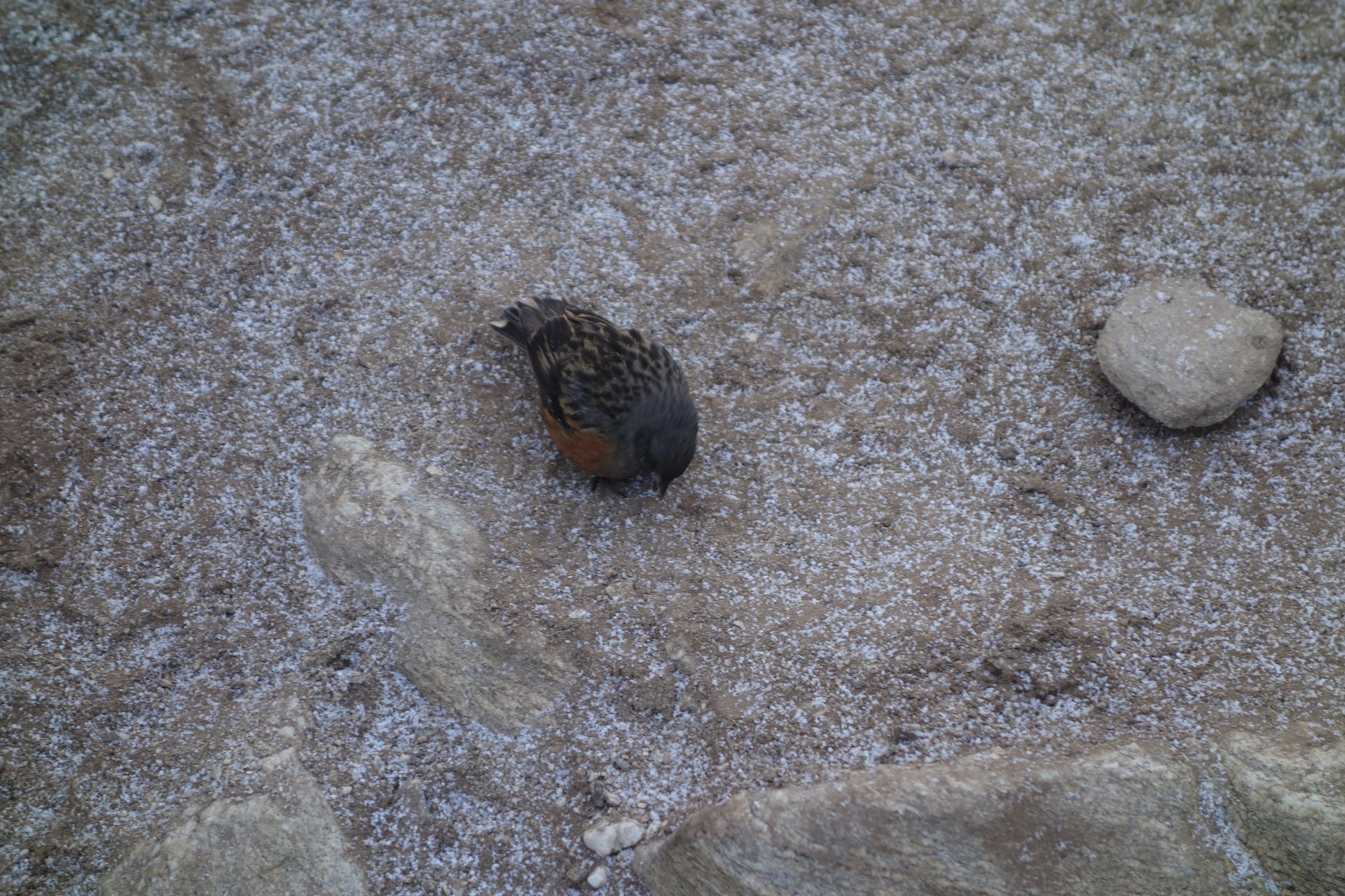
Phakding is a riverside village on the Dudh Koshi and the usual first overnight stop after flying into Lukla. The gentle walk here lets trekkers settle into the trail before the climb to Namche Bazaar.
Read place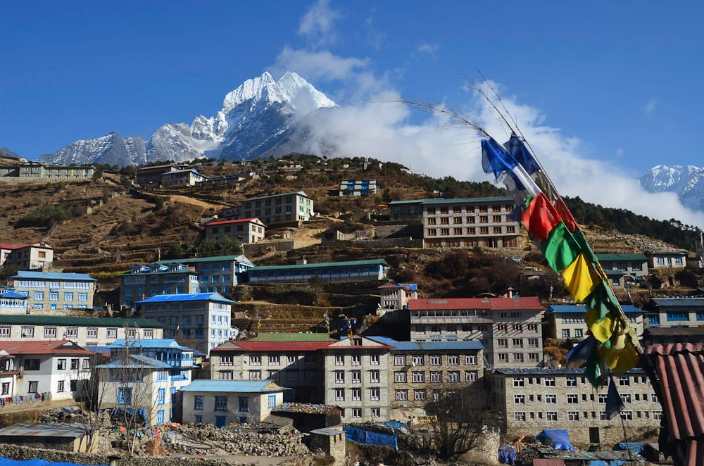
Town / city
Namche Bazaar
नाम्चे बजार
3,440 m
Namche Bazaar is the Sherpa capital of the Khumbu, a horseshoe-shaped town built into a hillside high above the Dudh Koshi. It is the region’s main trading hub, with lodges, bakeries, gear shops, banks and a Saturday market.
Read place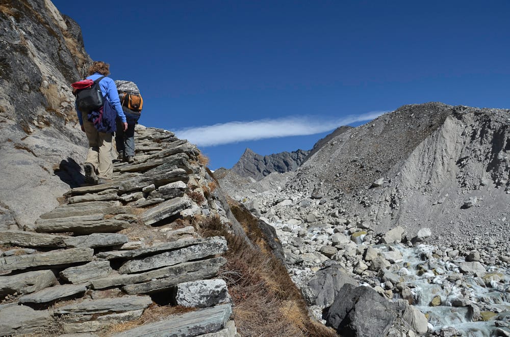
Lake
Gokyo Lakes
गोक्यो ताल
4,700 m
The Gokyo Lakes are a chain of six turquoise glacial lakes in the upper Dudh Koshi valley, among the highest freshwater lake systems in the world. They were designated a Ramsar wetland in 2007 and are sacred to both Hindus and Buddhists.
Read place