

Pass
Cho La Pass
चो ला
Cho La is the pass connecting the Everest Base Camp valley with the Gokyo valley, crossed between Dzongla and Thagnak. The east side climbs over a small glacier, which can be icy. It is the key link on the Everest Three Passes and EBC Gokyo Lakes treks.
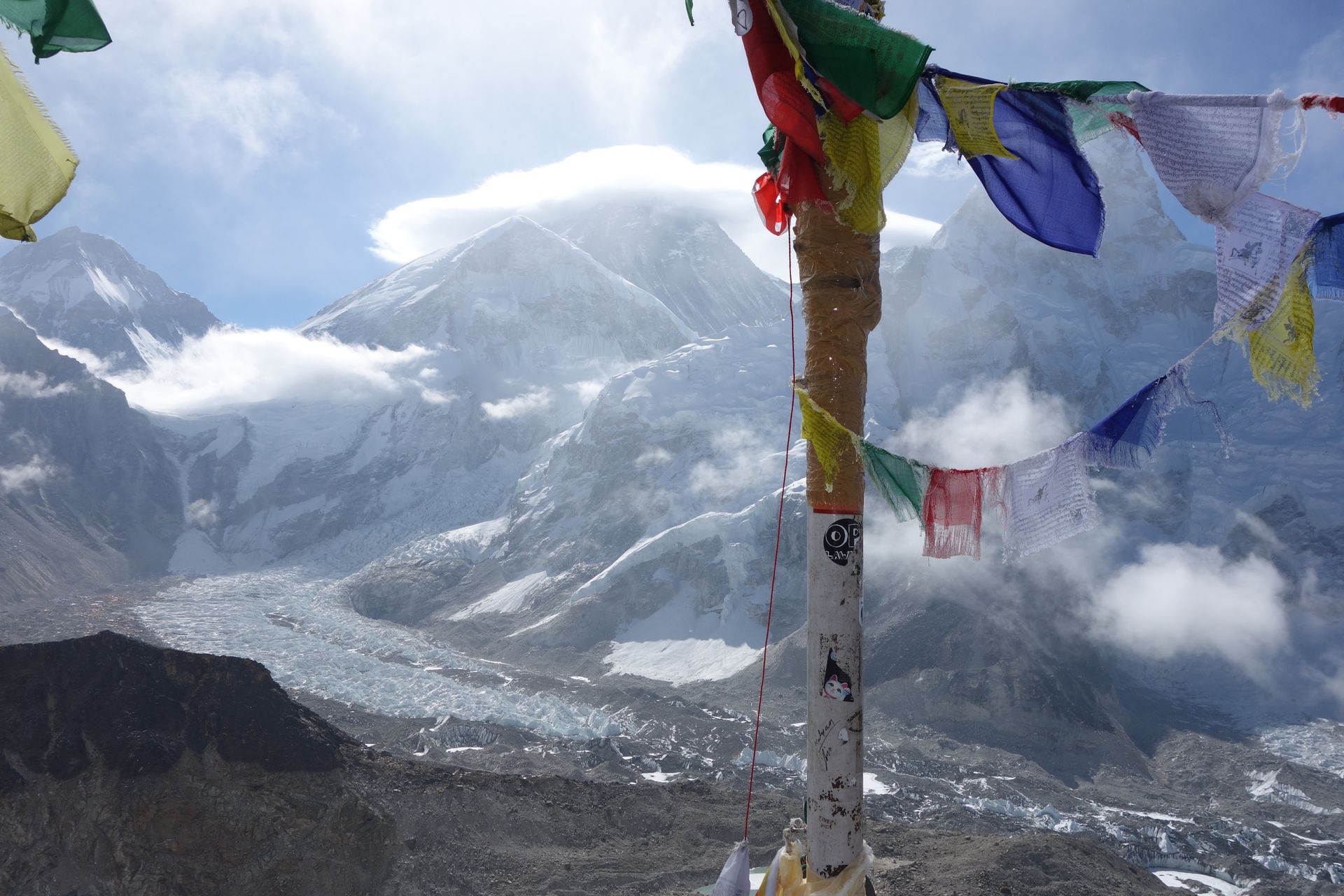
- Elevation: ~5,420 m / 17,782 ft
- Type: Mountain pass
- Region: Everest Region
- District: Solukhumbu
- Treks: Everest Three Passes Trek, EBC Gokyo Lakes Trek
About Cho La Pass
Cho La Pass is one of the most famous and challenging high-altitude mountain passes in Nepal's Everest region. Located at approximately 5,420 metres (17,782 feet) above sea level, it connects the Gokyo Valley with the Khumbu Valley, providing an adventurous route between the beautiful Gokyo Lakes and the Everest Base Camp trekking region.
Surrounded by rugged Himalayan peaks, glaciers, rocky ridges and snow-covered landscapes, Cho La Pass is a major highlight of the Everest Three Passes Trek. The crossing is particularly known for its steep rocky trail, icy sections and spectacular views of mountains such as Cholatse, Lobuche East, Ama Dablam and other peaks in the Khumbu region.
Unlike the more frequently travelled main Everest Base Camp trail, Cho La offers a demanding high-altitude adventure through remote mountain terrain. Trekkers commonly cross between Thagnak (Dragnag) and Dzongla, making it an important link between the Gokyo and Everest Base Camp routes.
Location and Altitude
Cho La Pass is located in the Solukhumbu District of Koshi Province, within Sagarmatha National Park. It lies between Dzongla on the Everest Base Camp side and Thagnak (Dragnag) in the Gokyo Valley.
- Location: Khumbu region, Solukhumbu, Nepal
- Altitude: Approximately 5,420 metres (17,782 feet)
- Mountain range: Mahalangur Himal
- Eastern side: Dzongla
- Western side: Thagnak (Dragnag)
- Nearest major destination: Gokyo and Lobuche
- National park: Sagarmatha National Park
- Famous for: Everest Three Passes Trek and glacier crossing
- Main connecting valleys: Khumbu Valley and Gokyo Valley
Treks That Pass Through Cho La Pass
Cho La Pass is an important crossing on trekking routes that connect the Everest Base Camp region with the Gokyo Valley.
Everest Three Passes Trek: Cho La is one of the three major mountain passes on this challenging circuit, alongside Kongma La and Renjo La. It connects Dzongla with Thagnak and allows trekkers to explore both the Everest Base Camp and Gokyo regions.
Everest Base Camp and Gokyo Lakes Trek: This popular combined itinerary includes Cho La to connect the classic Everest Base Camp route with the beautiful Gokyo Lakes.
Gokyo Lakes Trek via Cho La: Trekkers can visit the Gokyo Lakes and Gokyo Ri before crossing Cho La towards Dzongla, Lobuche and Everest Base Camp.
Gokyo to Everest Base Camp Route: The pass provides a direct high-altitude connection between the Gokyo Valley and the Khumbu Valley without descending to the lower settlements.
The usual crossing between Dzongla and Thagnak takes approximately 6–8 hours, depending on weather, snow conditions, walking pace and physical fitness.
Tea Houses and Accommodation Near Cho La Pass
There are no permanent tea houses, lodges or accommodation facilities at Cho La Pass itself. Trekkers generally stay in Dzongla before crossing and Thagnak after completing the journey.
Dzongla: This small mountain settlement on the eastern side of Cho La has basic tea houses and lodges. Visitors can find simple rooms, shared bathrooms and dining areas serving meals such as dal bhat, noodles, soups, rice and hot drinks.
Thagnak (Dragnag): Located on the western side of the pass, Thagnak is a small settlement with basic mountain accommodation. Its tea houses provide simple rooms and meals for trekkers travelling between Cho La and Gokyo.
Gokyo: Trekkers continuing beyond Thagnak can reach Gokyo village, where additional tea houses and lodges offer accommodation, meals and basic trekking services.
Facilities are limited compared with larger villages such as Namche Bazaar. Trekkers should carry enough water, snacks, warm clothing and essential supplies for the entire crossing.
Nature and Landscape of Cho La Pass
Cho La Pass is surrounded by spectacular Himalayan scenery, featuring glaciers, rocky mountain ridges, snow-covered slopes and dramatic alpine valleys. Its elevated position provides a remarkable view of the mountains separating the Khumbu and Gokyo regions.
The landscape on the eastern approach from Dzongla consists of steep rocky slopes, boulder fields and rugged mountain terrain. Near the summit, trekkers encounter glaciated ground that may be covered with snow and ice. The western descent leads towards Thagnak and the enormous Ngozumpa Glacier, one of the most prominent features of the Gokyo Valley.
The surrounding mountains include Cholatse, Taboche, Lobuche East and other Himalayan peaks. The contrast between the white glaciers, dark rocky ridges and distant snow-covered mountains makes the pass an excellent destination for mountain photography.
Vegetation is extremely limited at this altitude. The surrounding landscape is mainly composed of exposed rock, gravel, glacial deposits and seasonal snow. Wildlife sightings are uncommon near the pass, although the wider Sagarmatha National Park provides habitat for Himalayan species such as musk deer, Himalayan tahr and snow leopard.
Best Time to Visit Cho La Pass
The best seasons to cross Cho La Pass are spring (March to May) and autumn (September to November). These periods generally provide more favourable weather and better mountain visibility, although snow and ice can remain on the pass.
- Spring (March–May): A popular trekking season with longer daylight hours and generally favourable conditions. Snow may remain on the upper glacier section, particularly early in the season.
- Autumn (September–November): Often the best period for clear skies, mountain photography and stable trekking conditions.
- Winter (December–February): Heavy snowfall, freezing temperatures and icy trails can make the pass difficult or inaccessible.
- Monsoon (June–August): Rain, cloud and poor visibility make this a less favourable period for crossing high mountain terrain.
Even during spring and autumn, conditions can change quickly. Trekkers should check local weather and trail reports before attempting the crossing.
Main Attractions of Cho La Pass
Cho La Glacier: The snow- and ice-covered section near the summit is one of the most distinctive features of the crossing. It creates an exciting high-altitude trekking experience.
Cholatse Mountain: The impressive mountain scenery around Cho La includes views of Cholatse, one of the most recognisable peaks in the Khumbu region.
Ngozumpa Glacier: The western side of the pass leads towards the vast Ngozumpa Glacier, an important natural landmark of the Gokyo Valley.
Gokyo Lakes: The beautiful turquoise glacial lakes are among the major attractions accessible through the Cho La trekking route.
Dzongla Village: A small and peaceful mountain settlement on the eastern side of the pass, offering beautiful views of surrounding Himalayan peaks.
Thagnak Village: A remote high-altitude settlement below the Ngozumpa Glacier moraine, serving as an important resting point after the crossing.
Everest Three Passes Trek: Cho La is a major highlight of this adventurous trekking circuit, connecting two beautiful valleys of the Everest region.
Trekking Difficulty and Safety
Cho La Pass is considered a strenuous and challenging high-altitude crossing. The route includes steep rocky ascents, uneven boulder fields, snow-covered terrain and a glaciated section near the summit. The glacier crossing can be particularly demanding when the surface is icy or covered with fresh snow.
Under suitable conditions, it is generally completed as a high-altitude trekking route rather than a technical mountaineering climb. However, the presence of ice and changing glacier conditions means trekkers should not underestimate the difficulty.
Important safety recommendations include:
- Start early in the morning to allow enough time for the crossing.
- Hire an experienced local guide familiar with the route and glacier conditions.
- Carry suitable traction equipment, such as microspikes or crampons, depending on current conditions.
- Wear warm layered clothing, waterproof outerwear and sturdy trekking boots.
- Carry sufficient drinking water, snacks and a packed lunch.
- Check the weather and snow conditions before leaving Dzongla or Thagnak.
- Avoid crossing during heavy snowfall, poor visibility or unsafe glacier conditions.
- Maintain proper acclimatization before reaching elevations above 5,000 metres.
Trekkers who cannot safely cross Cho La may need to use a longer alternative route through lower settlements such as Phortse and Machhermo, depending on their itinerary and local conditions.
Where is Cho La Pass?
The exact point on the Himalaya trail, with nearby places for context.
On this map
Nearby places
Village
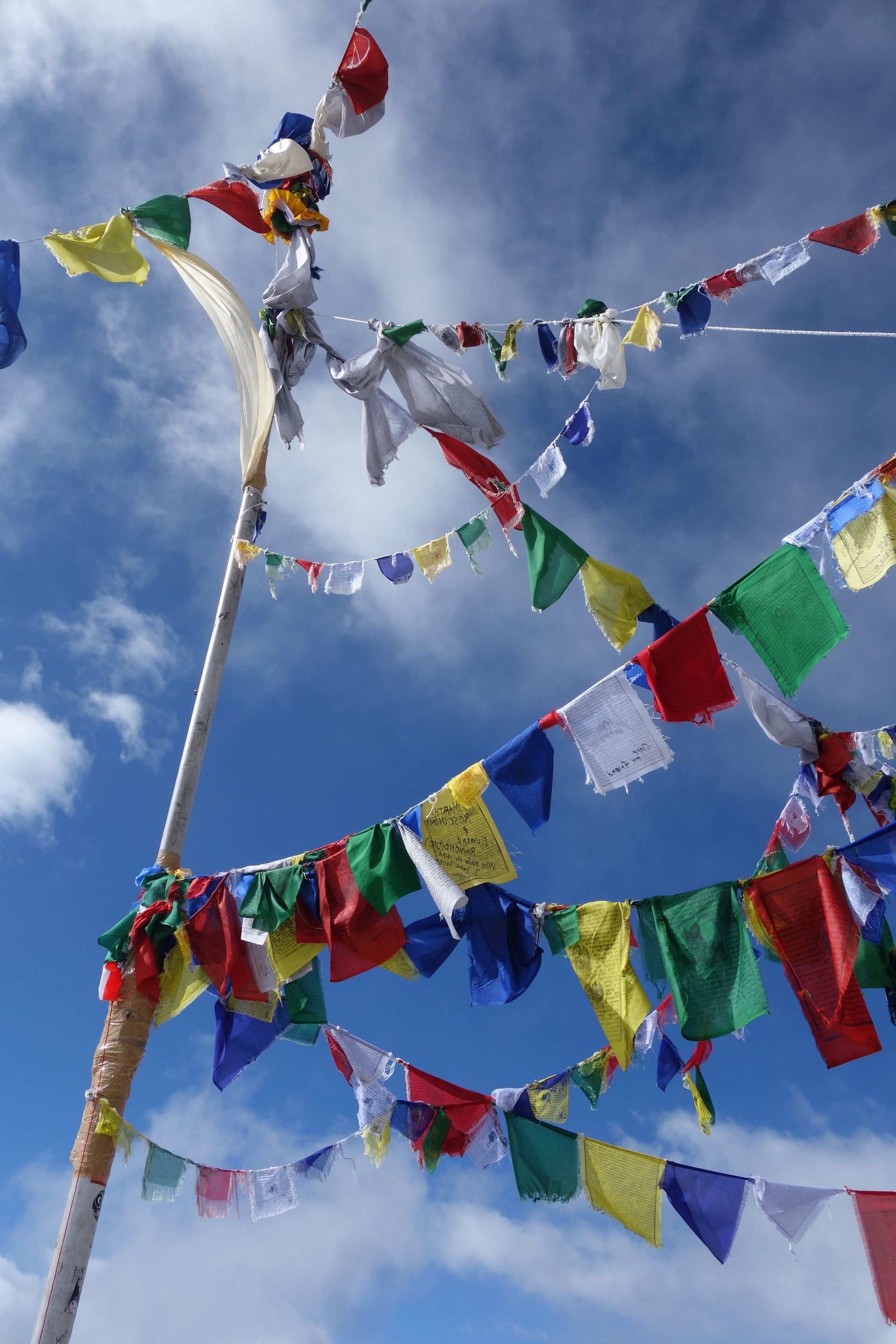
Dzongla
जोङ्ला
4,830 m
Dzongla is a tiny settlement of a few lodges below the Cho La, set beneath the north face of Cholatse. Trekkers heading west from Lobuche stay here before crossing the pass to Gokyo. Views across to Ama Dablam and Taboche at sunset are a highlight.
Read place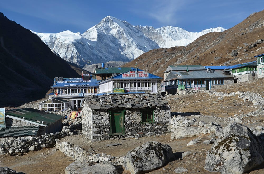
Village
Gokyo
गोक्यो
4,790 m
Gokyo is a lakeside village on the shore of Dudh Pokhari, the third Gokyo lake, beside the Ngozumpa Glacier. It is the main base for climbing Gokyo Ri and exploring the upper lakes. Gokyo is the hub of the western Khumbu, linked to Everest Base Camp by the Cho La and to Thame by the Renjo La.
Read place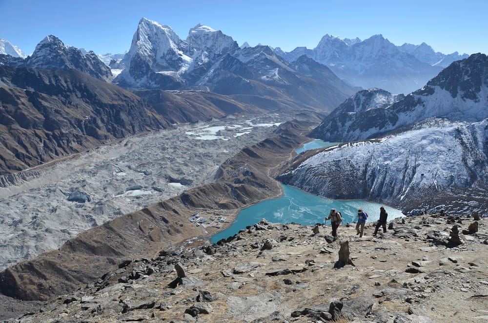
Glacier
Ngozumpa Glacier
ङोजुम्पा हिमनदी
4,600 m
The Ngozumpa Glacier is the longest glacier in Nepal, flowing about 36 km south from Cho Oyu. Its rubble-covered surface lies right next to Gokyo village. Trekkers crossing between Gokyo and the Cho La walk across the glacier on a shifting rocky trail.
Read place